It was more like “Follow the gust winds…oh my!”…… but we must say, we have had some incredible days of sailing on this passage. Typically we don’t enjoy downwind sailing but these trade winds up north in Australia proved to be pretty consistent in both strength and direction this time of year and we took full advantage of it!
Our trip was a total 517 nautical miles and took us 14 days that includes a few days waiting out weather at Lizard island. Thom on SV Fathom, our buddy boat, is aboard a 28 foot Vancouver. Compared to our 45 footer, our boat speeds vary since speed is partially based on the length of a boats waterline. This means Thom and our departure and arrival times varied and we often couldn’t sail “side by side”. However, with that said, Thom beat us to multiple anchorages, despite his earlier departure time….this just means he is a GREAT sailor! As buddy boats, there are lots of discussions about how each vessels feels about weather conditions and miles put in. We all decided to do day hops instead of overnight passages in these reef ridden waters. This meant though that by the time we got to our evening anchorage, we didn’t have time to go ashore and poke around…it was more like dinner, then put things back, and sleep for the next trip. We also had to decide on certain anchoring spots as some are not as protected or holding not as good so for each trip we would pow wow and discuss weather and the best and worst scenarios and what our plan A and B is.
This will be a brief post of weather conditions and sailing configurations….of course some fun had along the way : )
Cairns to Low Islet –37 NM; 20-25 knots, gusts up to 30 knots; Jib only; 6.16 average speed over ground (SOG)
Not a lot to worry about on this trip as the miles were low and the anchorage we heard was decently protected. A great way to start our
Thom looking to set anchor at Low Islet…unforuntely for Thom we got the last of the 3 blue mooring balls though we did offer it up. It was a busy place for charter boats being close to Cairns. The anchorage was super rolly due to the swell wrapping around the fringing reefs that has been kicked up by all the wind.Google image of Low Islet and where we anchored.As soon as we anchored this HUGE fish swam and circlied our boat. Later we saw the sam fish amongst 2 black tip reef sharks?! Dinner for the sharks or just playmates?!We don’t have a good fish book to identify what kind of fish this is…anyone know?
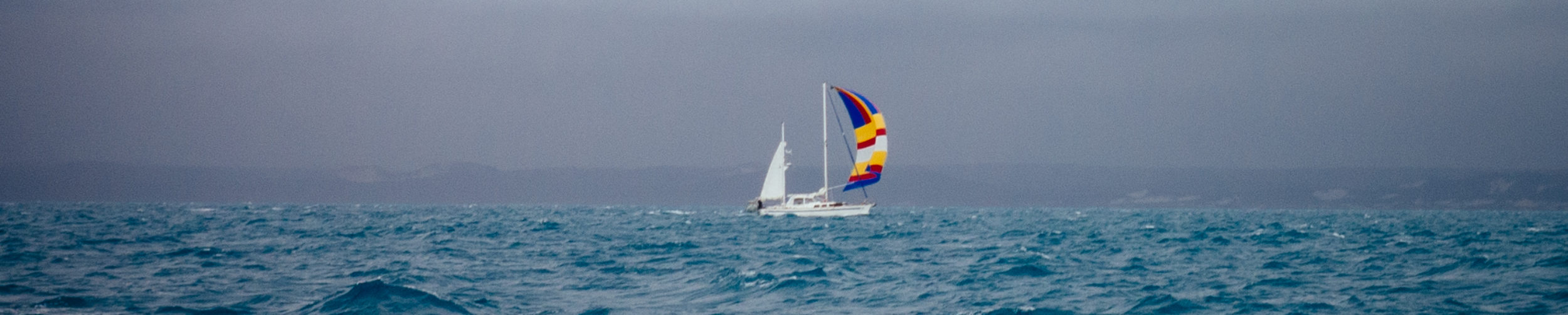
Low Islet to Hope Island“HAPPY JULY 4TH” – 41 NM; 25-30 knots, gusts up to 35 knots; Jib and mizzen; 6.83 average SOG.
Happy 4th of July….do you see our friends SV Henrietta in the back ground?Google image of our anchorage at Hope Island…we originally were a bit unsure about this anchorage as it is behind a sliver of sand and a few trees. Additionally it was surrounded by reefs. It was blowing pretty good but we decided to stay course and was pleasantly surprised.This photo does not give justice to when we were coming into the anchorage. Of course we had a huge squall which reduced visablity so it was hard to see the reefs and depended on our chart plotter to be correct. I was up on the bow anyways…getting hammered by the wind waves as we turned into the wind towards the anchorage. Sails in we didn’t have much stability so the boat was pitching quite a bit (bow into the waves). We planned to do a 4th of July dinner here but it was too windy…surprisingly the reefs kept the swell down and there was very little roll to be had. I think we all slept pretty well that night.
Hope Island to Cape Flattery- 47 NM; 20-25 knots, gusts up to 30 knots; Jib and mizzen reefed; 6.71 average SOG.
Photo courtesy of Thom: We are in major shipping channels for both cargo ships and military vessels. We have never been hailed by a commercial vessel before but we did today. The channel pinched right about where this photo was taken and the cargo ship just wanted to make sure we stay our course and will overtake us on our port (left) side.Our friends on SV Henrietta: Captain Michael and crew Caroline and Joyce who joined Michael, who has been solo sailing since the UK, in Cairns.Google image of the anchorage at Flattery Bay. There is a sand bar we chose to go around…others went over it and saved 30-45 minutes…oh well.SV Henrietta and SV Fathom anchored along side us at Flattery Bay. It gusted over the hills here and it sometimes felt like it was blowing 40 knots!
Cape Flattery to Lizard island – 21 NM; 10-15 knots, gusts up to 20 knots; Jib and mizzen; 5.25 average SOG.
Google image of our anchorage at Lizard Island. Lots of reefs but good holding in sand. We anchored in about 24 feet of water. The island is a protected National Park, with just one exclusive resort, 40 rooms and suites, and 24 pristine sandy beaches. Nearby are three smaller islands – Palfrey, South and Bird, which together with Lizard, form the Lizard Island Group.
Cooks Lookout-when we dropped anchor, We picked up Thom and headed to shore to hike the famous Cooks Lookout point trail. Let’s just say I am terribly out of shape. Thank goodness Thom heard me huffing and puffing and would stop every little bit…if it was just Trevor and I…Trevor would of kept on going. The weather was perfect as we had heard it can get cloudy at the top of Cook’s Lookout and the views are not good and the wind was perfect…not too windy where you felt like you were going to fall off a ledge but the wind piped up enough to keep you cool in sun. The hike itself: The first part is the hardest as you scramble up sheer rock cliffs but then you get up to the ridge and walk up. The name Cook’s Look comes from Captain James Cook who landed on Lizard Island as a means of finding his way out of the Great Barrier Reef. Cook climbed the mountain to find safe passage out of the reef while his ship the Endeavour was being repaired at what we now call Cooktown.
View of the anchorage on the way up to the top of the hill.Slow Flight, Fathom, Henrietta, Starry Horizons, are all out there…looking good!Thom and Trevor acting out Captain Cook….. You could literally see the outer reefs from up top…it was really spectacular to imagine what Cook was thinking back in the 1700’s.At the top there was a large pile of rocks…used for possible aboriginal ceremonies….it wasn’t clear.A compass to make the sopt. My camera got all fogged up so sorry about the image quality.Trevor noticed a box and opened it… inside was not a snake or anything deadly but rather a guest book, pens and boat cards. Don;t forget to sign it if you climb the lookout : )
4th of July BBQ-The same night we anchored we knew we had to have our “official’ 4th of July party. Trevor prepared baby back ribs, potato salad, coleslaw, and hot dogs for 8 people….Slow Flight style!
Last time we had the nautical American flag flying was last year in French Polynesia where we celebrated in style with our old fleet SV Fandango, SV Me Too, and SV Mysticeti. Last year we fired off old flares….abrutly stopped by an angry French woman. This year we thought we should learn from past experiences and figured the Australian government would not be so happy if we did the same here. Thinking of you Ian from SV Fandango…who almost cought Slow Flight on fire last year (LOL)From Left o right: Joyce (crew on SV Henrietta), David (SV Starry Horizons), Caroline (crew on SV Henrietta), Michael (Captain on SV Henrietta), Thom (SV Fathom).Amy (SV Starry Horizons), and of course Trevor
Boat duties – It has only been a few days from Cairns…our
We purchased this electric spinner way back in American Samoa last year….I think Trevor was more excited to do laundry than I was. It worked like a charm and cut the dry time by more than half!When we turned on the inverter since leaving Cairns and installing new batteries, under load, it would shut off…Trevor found both negative and positive battery cables were not crimped as secure as they could of been and that was creating a short. We couldn’t of let it go too long as it would of caused a fire due to the wires overheating.New cables…we were a little unsure if the crimping tool we had on aboard would work as these wires are seriously large. But our hydraulic wire crimper did the job…thank goodness!Finally…got a chacne to get into the water…though it was blowing 35 over the top of the hill right into the anchorage…but we didn’t care. It was nice to get wet and our last chance to clean the bottom until we get to Indonesia.
Lagoon walk – A bunch of us decided to stay and wait out a big blow that was heading our way. We figured we could leave now and wait it out at an anchorage closer to the main land of Australia but we decided to stay put; It was beautiful here, lots to do, great people, and NO CROCODILES! So we took another walk to the otherside of the island…to the Lagoon.
A short walk through some bush…it was really pleasnt. We met Robin on a catermaran, SV Second Wind, who lives in Cooktown, not far away and spends lots of time here at Lizard Island. She joined us and acted as our tour guide telling us about how things have changed on the island and cool local knowledge.Ummmm….I almost walked right into this guy…..Robin showed us these little native fruits…not sure waht they are called but they taste like passion fruit. Off the vine these little pods lie on the ground and you can just pick one up and squirt the fruit right into your mouth. It was delicious!At the Lagoon, Trevor takes a stroll by himself….
Happy hour on SV Starry Horizons-That night after the Lagoon walk, Amy and David invited all of us for Happy Hour on their brand new Fountaine Pajot Helia 44 catamaran. It was like living in a condo on the water…incredibly modern and spacious.
Everyone chatting it up on SV Starry Horizons enjoying snacks and drinks, meeting each other for the first time for some of us.
Marlin bar –Waiting out weather can sometimes be arrivating but when you are at Lizard Island…there is nothing to worry about. The Marlin bar is open to us “yachties” Monday, Wednesday and Fridays. It is part of the 5 star resort on the island but has a more bar feel to it. Since more boats had come in to wait out the wind we all thought a stop at the Marlin Bar was appropriate.
Trevor doing something…probably checking his wallet for cash…. prices weren’t bad for island prices : )More new freinds! from left to right: Don and Erica (SV Wasco-they are from WA and CA and it was nice to chat it up with fellow americans lol); us; Carlos and Linda (SV Mirniy Okean-Carlos is a professional tennis player and Linda is half Tahitian and French from New Caledonia. She teaches Tahitian dancing); Tony and Robin (SV Second Wind-they live in Cooktown and had a sport fishing company locally. They have a lot of local knowledge about the anchorages and weather for everyone and was so willing to share…truly amazing people).
Research center –Robin told us there was a research center on the island and that they sometimes gave tours of their facilities. I radioed them to see if they offered anything while we were waiting out weather and they kindy organized a tour for us. On our way back, a few of us walked a different way…Don and Erica, Thom and us…kind of got lost… it was a pretty funny scene but Don climbed up a rock to see where the trail was supposed to be and we found our way…thank goodness RObin told me beforehand that there were no snakes on this island…otherwise this “off the path” walking would of freaked me out!
Lyle is the director and has a staff of 3. He has been on Lizard Island for 25 years!!!! He told us all about who comes here to do research, about the changes the island has endured through his years and cyclones, and the changing conditions of the reefs and about the sealife in geenral. He was a wealth of information almost too much to take in.Personally I am not interested in getting my doctorate but if you want some light reading, you can read all the thesis and published research that has been conducted over all the years of this centers operations..until everything went digital : )There was only 1 team working at the moment…from Sweden I think… they were just coming back when we were making our way back to the boats….
Weather and anchorage meeting on SV Second Wind – We all were leaving the next morning and all of us expressed interest in getting some local information from Tony on SV Second Wind. So kindy they hosted us on thier boat and we all brought our technolgy and chatted about the passage further up north. BONUS: I also got my puppy fix!
Drybacks, laptops, phones, tablets…. I also brought beer and gin : )Meet Sassy…she was such a bonus for me…got to get my some puppy!
Lizard Island to Bathurst bay – 73 NM; 15-20 knots, gusts up to 25 knots; Jib and mizzen reefed and later cadded our main double reefed super comforatble ride downwind; 7.12 average SOG. These next few legs we did hard miles. It was good that we rested up at Lizard Island as Thom had to wake up at 3 am just to be sure he could arrive at the next anchorage before sundown.
Dolhpins on the bow! It never gets old : )Really large boulder raock islands near the mainland….beuatiful to gaze at!Google image of our anchorage at Bathurst bay.Thom actually beat us to the anchorage…. we loved that! the landscape, from the perspective from the boat, looked like the sides of the hills were boulders and the tops of the hills were covered in shrubs.
Bathurst Bay to Morris Island – 74 NM; 5-15 knots, no gusts…hardly any wind; Spinnaker out and engine on; 6.72 average SOG. This was actually ok…there are 2 separate route: the inner reef or the outer reef shipping channels. The outer channel would require us to do an overnight but the inner channel didn;t have great anchorages in heavy winds. We decided to take the inner channel and still try to make day hops…the wind was light and was perfect to stop at Morris Island. Morris Island could be a really uncomfortable anchorage if the wind and swell is up but we lucked out and had a great stop here…we just wished we could of gone ashore but we needed to keep going.
Calm seas…we had read that when a calm happens in these northern parts it is truly a CALM…well we can confrim this.We saw a school of huge tuna jumping…we looked for dolphins who might be feeding but didn’t see any.Morris Island anchorage with SV Wasco, SV Fathom (who beat us in again LOL), and SV Christophe already anchored.Photo courtesy of Thom: So Thom….caught this guy and was willing to share…we generally wouldn’t drop the dinghy when we all have to leave early the next morning but the next day’s tip was only 60 miles and we thought it best to eat this guy up fresh! It’s a 60 cm Yellow tail king fish according to Thom.So it begins…the contract between Trevor and Thom and fishing…if THom catches, Trevor will cook it….a handshake and it’s done! We are so grateful to Thom for sharing his amazing catch. Dinner was fantastic…as fresh fish always is….nicely done boys!Google image of Morris island…the only sand spit is above water and the fringing reef kept the swell at bay.
Morris Island to Portland roads – 61 NM; 10-15 knots, gusts up to 20; Jib and mizzen; 6.42 average SOG. I had been looking forward to this anchorage for some time. I think I even talked Thom to stop here just for the cafe we heard served amazing food and how remote it is. People rent vehicles or get a tour just to eat at this cafe. Unfortunately they were booked for the evening, as you can image they are a small establishment. Thom inquired at the cafe and we heard the owners were not as friendly as we may have anticipated…maybe they were just busy. None the less, we had heard great things about this place and hopefully you will have a better experience than we did. Plan B was Butter Chicken and rice on Slow Flight : )
Google image of the anchorage at Portland roads.Being this far north, we needed to start really taking into consideration the tides when we drop anchor to be sure we have enough scope out depending on if we set anchor at low or high tide. At this anchorage we would experience a 9 foot tidal change!When we anchored..literally, we saw this reef shark swim around our boat. Trevor saw it first when he dropped the anchor..I ran and got the camera.Because we saw him swim underneath our bow….after i took a photo…we had to continue to set the anchor…but I saw an image on our sonar (it measures depth and is the colorful screen on the right) and low and be hold…that is what a shark looks like on sonar…in case you were curious….Just be careful when you plan your trip ashore in the dinghy….there is a reef surrounding the ancorage that dries at low tide. We found a sneaky way in from Tony back at Lizard Island….we had to walk the dinghy quite a ways at low tide….we thought if were were going to have dinner at the cafe, we would be leaving shore at high tide…. thank goodness Trevor installed the dinghy wheels back at Cairns.I was sad but that’s ok…can’t do everything. It would of been better if we could of rang the cafe first but no one had internet to get their phone number or the foresight to do so in Cairns.SV Fathom, fishing vessel and Slow Flight at anchor from shore.
Portland Roads to Margaret Bay – 48 NM; 15-20 knots, 25 gusts; Spinnaker out with mizzen reefed; 7.56 average SOG. This was our fastest sail EVER!!!! We kept up with a 50 foot catamaran until we had to turn and change our wind angle slightly. We saw 8-10 knots consistently…probably pushing the spinnaker to its max and those who saw us sailing that day…said so! When the wind kicked up a bit and the wind angle changed…we took down the spinnaker…almost lost Trevor! He was holding the lines to pull in the spinnaker while I was in the cockpit letting the tension off the lines and a gust took the spinnaker up and out and I saw Trevor’s feet leave the deck floor! Wew changed sails to our Jib and mizzen but we were still seeing 7-8 knots of speed. It was a great day of sailing : )
We were never really sailing alone up this coast as we were all headed in the same direction. SOmetime we would pass others and others would pass us. Always a photo opportunity. Here is SV Fathom to the left and SV Christophe to the right (the 50 foot catamaran we kept up with).Channel markerGoogle image of our anchorage at Margret Bay.Fathom at anchor next to us at Margaret Bay. Pretty calm bay and the landscape was low lying…a contrast to the boulders and higher hills thus far.
Margaret Bay to Escape River – 70 NM; 15-20 knots, 25 gusts; spinnaker out all day; 7.17 average SOG.
Generally we don;t fly the spinnaker but because we had such good wind and the wind angle demanded a spinnaker.
However…with that siad, we don;t have a ton of expereince rigging it up and making it fly at it’s best potential. SO Trevor gets creative and rigged this snatch block and a line to a cleat to keep the port side tight and sail full. Ingenious!Google image of the entrance and anchorage we took at Escape river. There is a sand bar to get over as well and our chart plotter said it was about 8.5 feet of depth. Ekkkss! The guide books tell you to go farther into the river but Tony on SV Second Wind told us we could find a shelf of sand and coral right behind Sharp Rock. Well…we arrived first so we had to find a good place to anchor. See our yellow tracks? We tried multiple times to find a bottom that would hold and a shallow enough spot to anchor in. We also had to keep away from pearl buoys.Photo courtesy of Thom: Meet “Geoffrey” …Thom radios us and tells us he just caught a 20 pound yellow fin tuna….and a shark earlier in the day!!!!Time for Trevor to keep his half of the deal so Thom brought it over and Trevor went to work!There was so much meat…some frozen for later…but just look at that filet!End result…Thom was happy. Trevor rolled sushi and seared steaks of yellowfin served with rice (of course) and whatever veggies we had left in the fridge….. With a gin and tonic in hand!
Escape river to Horn Island/Thursday island – 45 NM; 15-20 knots, 25 gusts; Jib and mizzen; 5 average SOG. We specifically wanted Thom to lead us into the anchorage at Thursday/Horn Island. He has been sailing up the coast since Sydney….massive miles and this was a huge accomplishment. So we would reef the jib to slow down or let it out to pick up speed to keep him right beside us or just in front of us.
Technically, we had a big challenge: Albany passage where the current running through this small cut in between islands can kick up to 4-6 knots and you need to time it correctly. Again, we lucked out as the tide matched daylight hours and we were able to ride the tide all the way to the anchorage.
Thom flying wing on wing through Albany passagePhoto coutresey of Tom: Just as exited Albany pass, we rounded Cape York and thought it appropriate to take this opportunity to do a photo shoot of each others boats. I love this one Thom took of us with Cape York in the background and Thom doing his solo sailing thing!Google image of Horn Island anchorage. Thursday Island is just to the left here but because of the wind direction, Horn Island was a better and more protected anchorage.This is what our AIS picked up as we came into the anchorage…most of these boats will be heading to Indonesia with us in the Sail 2 Indonesia rally. But my oh my..I think I counted 30+ boats and of course more came and left.
It has been such a good sailing and we were lucky with the weather to be give us nearly perfect conditions to make each anchorage by daylight and light enough winds to make for secure holding at outer islands to make our schedule possible.
Thom on SV Fathom- we have made some incredible memories with you and so lucky to have had the opportunity to share these moments. The Fathom wall will continue : )
Photo courtesy of Thom…I love this one! Thanks Thom for being such an incredible buddy boat…we will miss our “weather router”. We are honored that you decided to sail with us because we know how much of a pain in the butt we can be. Thank you for enduring us and our crazy ways. We will dearly miss you.